Explanations
Why Valentia hardly ever freezes, why Kerry’s mountains get four times Dublin’s rain, what a cold front does as it crosses, and how the readings behind every record on this site are taken. Further down: the jet stream, sea fog, sea breezes, why snow is rare, storms and surges, and the sky itself, from the aurora and noctilucent clouds to halos, glories and mirages, illustrated with photographs taken in Ireland. The explainers with charts use the almanac’s own 1991–2020 averages, and follows your region setting.
How the weather works
Also: Cloud atlas · Weather for kids
- Why Ireland is mild
- Why the west is wetter
- Depressions and fronts
- Highs and blocking
- Where the sun shines
- The shape of the year
- Frost and cold valleys
- How the weather is measured
Ireland’s climate in depth
- The jet stream and the NAO
- The sea around Ireland
- Inversions, fog and gloom
- Sea breezes and showers
- Why snow is rare, and when it comes
- Forecasting snow: the rules of thumb
- Cold spells
- Storms and sting jets
- Ex-hurricanes
- Storm surge and coastal floods
- Thunder and lightning
- Showers, hail and graupel
- Floods from rain and floods from thaw
- Tornadoes, funnel clouds and microbursts
- What the wind carries
- How the climate is changing
The sky
Why Ireland is mild
Ireland sits on the eastern edge of a wide ocean, in a belt where the wind blows mostly from the west. Water warms and cools far more slowly than land, so air that has crossed thousands of kilometres of Atlantic arrives cool in summer and mild in winter. The North Atlantic Drift, the northern end of the Gulf Stream system, keeps the sea off the west coast several degrees warmer in winter than its latitude alone would suggest.
The effect is strongest on the coasts that face the ocean. Inland, and especially in the north and on high ground, winters are colder and summer afternoons warmer, because the land heats and cools faster than the sea. The gap between the warmest and coldest months is one of the simplest measures of how “oceanic” a climate is.
More: Averages (30-year normals)Mountains and coastsIreland’s temperature since 1900
Why the west is wetter
Most of Ireland’s rain comes from Atlantic weather systems arriving from the south-west and west. When moist air meets the mountains of Kerry, Connemara, Mayo and Donegal it is forced to rise. Rising air cools, and cooler air can hold less water vapour, so the vapour condenses into cloud and falls as rain. Meteorologists call this orographic rain.
By the time the same air has crossed the country and come down the far side of the hills it has lost much of its moisture, and sinking air warms and dries. The east, and Dublin especially, lies in this rain shadow. A south-westerly that is soaking Kerry can leave Dublin bright and noticeably warmer.
More: Rainfall recordsWhich winds bring rainHow rare was that rain?
Depressions and fronts
A depression, or low, is a large swirl of air around an area of low pressure. Over Ireland the wind blows anticlockwise around it and slightly inwards, and most lows track from the Atlantic towards Scotland or Iceland, so Ireland is often on their southern side, in a south-westerly or westerly flow. Lows feed on the contrast between cold polar air and warm tropical air, and along the boundaries between the two lie fronts.
As a depression passes
The warm front comes first. High, thin cloud thickens and lowers over several hours, the wind backs towards the south and freshens, and steady rain sets in. Behind it lies the warm sector: mild, humid, overcast air with drizzle, heaviest on south- and west-facing hills. Then the cold front arrives, often with a short burst of heavier rain and a squall. The wind veers to the west or north-west, the temperature and dew point drop, the sky clears from the west and showers follow, sometimes with hail and thunder.
In winter several lows can follow each other across the Atlantic within days, which is why a stormy spell can bring gale after gale. A low that deepens very quickly (by 24 hPa or more in a day) is called a “weather bomb”; these bring the strongest winds.
More: Wind recordsNamed stormsAir pressure recordsWeather types
Highs and blocking
An anticyclone, or high, is a large dome of slowly sinking air. Sinking air warms and dries, so highs bring settled weather with light winds, which blow clockwise around them. What that weather feels like depends on the season. In summer a high over or near Ireland means sunshine and warm afternoons, and the longer it lasts the warmer it gets. In winter the same light winds and clear skies let heat escape at night, bringing frost and fog that can linger all day in sheltered valleys. Sometimes a high traps a layer of low cloud beneath it instead, giving days of grey, dry, “anticyclonic gloom”.
When a strong high settles to the north or north-west of Ireland, or over Scandinavia, it blocks the usual west-to-east procession of Atlantic lows and turns them aside. These blocking highs are behind most of Ireland’s cold spells, heatwaves and droughts, because they let the same weather persist for a week or more and can draw air from the continent or the Arctic instead of the Atlantic. The bitterly cold, snowy weeks of early 2010, December 2010 and late February 2018 all came with blocking, as did the long dry summers of 1976, 1995 and 2018.
More: Heatwaves and cold spellsDoes the weather stick?Weather patterns: NAO, AMO and El NiñoSudden stratospheric warmings
Where the sun shines
Sunshine follows the rain the other way round. The south-east and east coasts get the most, because they are furthest from the Atlantic’s cloud and in the shelter of the hills, and because on summer days sea breezes can keep the coast clear while cloud bubbles up inland. The north and west get the least.
Across the country May is usually the sunniest month, not June or July. Long days arrive before the warm, humid air that brings summer’s cloud, and late spring is often a settled time of year. December is the dullest: the sun is up for less than eight hours on the shortest days and stays low behind cloud and hills.
More: Sunshine recordsSunshine as a share of daylightDaylight
The shape of the year
The ocean slows the seasons down. The sun is highest in late June, but the sea goes on warming into August, so the warmest weeks come in the second half of July and August is nearly as warm as July, warmer at some coastal stations. The coldest weeks come in January and February, well after the shortest day.
Rain follows a different shape. Spring and early summer are the driest part of the year; autumn and early winter are the wettest, when the Atlantic is still warm and the storm track is at its most active.
More: Any month since 1853First and last warm days, and frost datesHow Ireland’s climate has changed
Frost and cold valleys
On a clear, calm night the ground loses heat to space and cools the air touching it. That cold air is denser than the air above, so it drains downhill and pools in valleys and hollows, like water. A frost hollow can be several degrees colder than a hillside a short distance away, and the coldest nights in Ireland are recorded at low-lying inland stations rather than on mountains. On those nights temperature rises with height for the first hundred metres or so: a temperature inversion.
Ireland’s air temperature is measured 1.25 m above the ground, inside a ventilated, white louvred screen that keeps out sunshine and rain. An air frost is when that reading drops below 0 °C. Ground frost is measured separately with a thermometer just above short grass, which is often several degrees colder; frost on the grass and on car windscreens can form when the air temperature is still above freezing. Coasts, especially in the west and south-west, rarely get air frost at all, because the nearby sea keeps the air from cooling far.
More: Cold valleys, warm hillsGround frostFrost datesHow often it snows
How the weather is measured
Two kinds of station
Synoptic stations, mostly at airports and on the coast, take readings every hour, around the clock, and send them at once for forecasting. They measure temperature, rainfall, wind, pressure, humidity, cloud, visibility and sunshine, and are now largely automatic. Climatological stations are run by volunteers, schools, farms and local bodies. They read their instruments once a day, at 09:00 UTC, and many have a much longer history at one site. Rainfall stations, the largest group by far, measure rain only.
The climate day
A once-a-day reading at 09:00 covers the 24 hours since 09:00 the day before. By convention the rainfall is credited to the day the period started, the maximum temperature to the same day, and the minimum to the day the period ended. So a station’s “rainfall on the 3rd” is what fell between 09:00 on the 3rd and 09:00 on the 4th. Synoptic stations report both 09–09 values and midnight-to-midnight values, and the two can differ a lot on a day when heavy rain or a sharp change of air mass came overnight. Records on this site say which they use.
The instruments
Rain is caught in a standard gauge with its rim 30 cm above short grass, away from walls and trees that would shelter or splash it. Wind is measured on a mast 10 m above open ground; a gust is the highest three-second average, and the mean wind is averaged over ten minutes. Pressure is corrected to sea level so that stations at different heights can be compared. Older stations measured sunshine with a Campbell–Stokes recorder, a glass sphere that focuses the sun to burn a trace across a card; most now use electronic sensors.
Why some readings are not counted
A record means something only if the instrument was exposed in the standard way. Readings from sites in the middle of a city, sheltered by buildings and warmed by them, are kept on their own station pages but are not used for records here. Where a station has moved, its records say so, and readings that do not fit their neighbours are checked before they are used.
More: Data quality policyGlossaryWhen stations opened and closedStation finder
Ireland’s climate in depth
The jet stream and the NAO
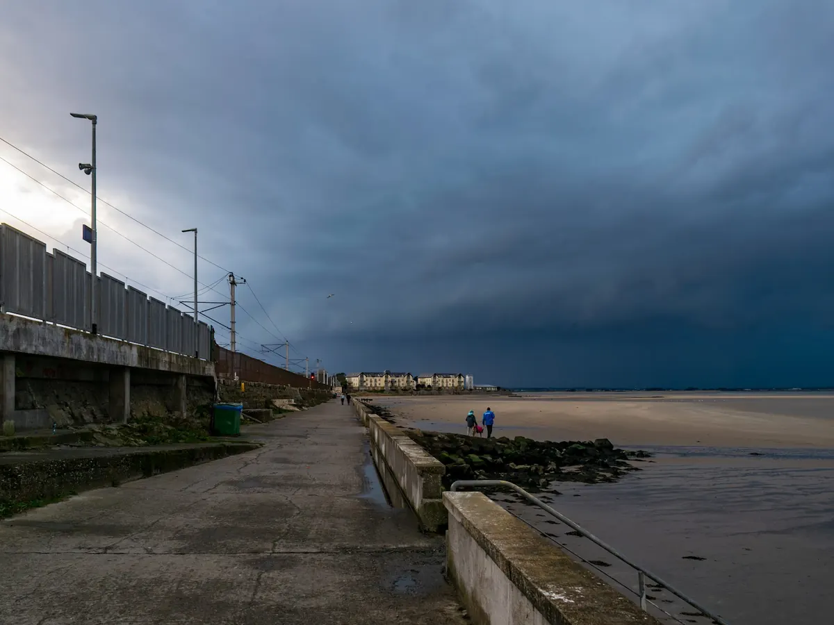
About ten kilometres up, a band of very fast wind called the jet stream circles the hemisphere from west to east. It forms where cold polar air meets warmer air to the south, and it is strongest in winter, when that contrast is greatest. Depressions form and deepen beneath it, and it steers them. Whether Ireland has a run of gales, a wet month or a long settled spell depends largely on where the jet is lying.
When the jet runs straight across the Atlantic and over or just north of Ireland, one depression follows another: mild, wet and windy, wettest in the west. When it buckles into large loops, highs can stall over or near Ireland for days or weeks (see Highs and blocking). In summer the jet is weaker and usually further north, which is why summer weather changes less quickly.
The North Atlantic Oscillation (NAO) is a simple measure of this: the difference in pressure between the Azores high and the Icelandic low. A strongly positive NAO means a strong westerly flow, and Irish winters are then usually mild, wet and stormy. A negative NAO means weaker westerlies, more blocking, and a better chance of cold, dry spells and winds from the north or east.
More: Weather patterns: NAO, AMO and El NiñoWeather typesWhich winds bring rainDoes the weather stick?
The sea around Ireland
No part of Ireland is far from the sea, and the sea sets the tone of the climate. It changes temperature slowly, lagging the seasons: the coastal waters are coldest in late winter and warmest in late summer, well after the shortest and longest days. That is why autumn on the coast is often milder than spring, and why the coldest weeks of the year come after midwinter.
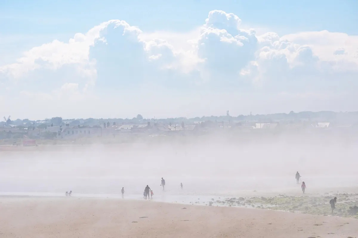
Sea fog forms when warm, moist air drifts over cooler water and is chilled from below until it condenses. Around Ireland it is most common in spring and early summer, when the sea is still cold, and it can sit just off the east and south coasts on days when a few kilometres inland are in hot sunshine. A light onshore breeze can push it over coastal towns for an afternoon, then draw it back out again.
The seas have warmed since records began, and spells of unusually warm water, called marine heatwaves, now come more often. Warm seas give milder nights on the coast, more moisture for rain and showers, and a little more energy for autumn storms.
More: Seas around Ireland since 1870Marine heatwavesSea and weather buoysFog and cloud
Inversions, fog and gloom
Air normally gets colder with height. On a calm, clear night the ground loses heat to space, chills the air touching it, and that cold, heavy air drains downhill and pools in valleys and low ground. The result is an inversion: a shallow layer of cold air near the ground with milder air above it. On such nights, hilltops can be several degrees warmer than the valleys below.
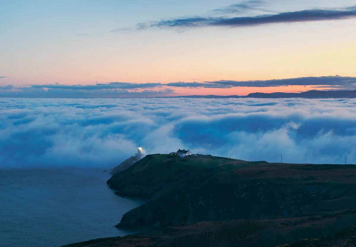
If the cold air is moist enough, it condenses into radiation fog. It forms first over rivers, bogs and low fields, thickens towards dawn and usually burns off by late morning. In late autumn and winter, when the sun is weak and the nights are long, it can last all day. From a hilltop above it, the fog looks like a sea, with the summits as islands.
Under a winter high, the inversion can trap a lid of low grey cloud for days: the so-called anticyclonic gloom. It is dry and calm but dull, and it holds smoke and traffic fumes near the ground, which is when the air quality in towns is often at its worst.
More: Cold valleys, warm hillsFog hours and clear daysAir quality and the weatherWeather balloons at Valentia
Sea breezes and showers
On a sunny day in spring or summer the land heats up much faster than the sea. The warm air over the land rises and cooler air from the sea flows in underneath to replace it: a sea breeze. It typically sets in by late morning, can reach some way inland by afternoon, and dies away in the evening. A beach can be cool and breezy while a town a few kilometres inland is the warmest place in the county.
Where sea breezes from two coasts meet, or a sea breeze meets the main wind, the air is forced up along a line, and showers or even thunderstorms can grow there. On sunny days, cumulus clouds often build over the land while the coasts stay clear, which is one reason the coasts, and the south-east in particular, are the sunniest parts of Ireland.
In winter the pattern flips. The sea is then warmer than the land, so showers form over the water and are carried onshore by the wind. Coasts facing the wind get them by day and by night, while places well inland or downwind of high ground stay much drier.
Why snow is rare, and when it comes
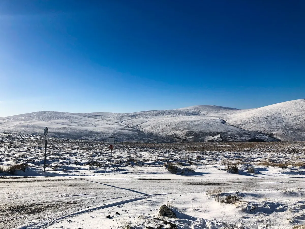
Most of Ireland’s rain arrives on mild Atlantic winds, so most wet days are far too warm for snow. Snow needs cold air to arrive first, and that cold air has to come from the north or the east. Even then, crossing the sea warms it from below, so snow at sea level often turns to sleet or rain while the hills above stay white.
A northerly or north-westerly brings snow showers off the sea, mainly to the north and west coasts and to high ground. An easterly is the classic snow wind for the east: very cold air from continental Europe crosses the Irish Sea, picks up moisture and dumps it as heavy showers on Dublin, Wicklow and Louth. The heaviest falls usually come when Atlantic fronts run into cold air that is already in place.
The cold spells that bring easterlies often follow a sudden stratospheric warming, when the cold vortex of winds high above the Arctic breaks down. Its effects can take a couple of weeks to reach the ground, and they do not always reach Ireland. Height matters too: the mountains see far more snow than the lowlands, and snow lies there much longer.
More: Snow eventsHow often it snowsSnow from spaceSudden stratospheric warmings
Forecasting snow: the rules of thumb
Whether rain turns to snow is decided in the lowest kilometre or two of air, and Irish snow is nearly always marginal: the sea is never far away and is rarely colder than 7 °C. Forecasters lean on a few rules of thumb, read from the model charts, and then adjust for height, distance from the sea and how heavy the precipitation will be.
| What to look at | Snow likely | Marginal: sleet, or snow on hills | Rain |
|---|---|---|---|
| Temperature at 850 hPa (about 1.5 km up) | −5 °C or lower | −2 to −5 °C | above −2 °C |
| Thickness of the air from 1000 to 500 hPa | below 522 dam | 522 to 528 dam | above 528 dam |
| Dew point at the ground | 0 °C or lower | 0 to 1.5 °C | above 1.5 °C |
| Wet-bulb freezing level | at or near the ground | about 100 to 300 m | above 400 m |
No single number decides it. Dry air matters as much as cold air: snowflakes falling into dry air evaporate a little and chill it, so with a dew point below freezing snow can reach the ground with the air at 2 or 3 °C. The same cooling is why heavy precipitation often turns rain to snow as it intensifies, and why snow can fall at sea level in a cold, dry easterly while a damp, westerly airmass with the same 850 hPa temperature only gives sleet.
For showers off the sea, the gap between the sea surface and the air above matters. When the air at 850 hPa is 13 °C or more colder than the sea, the sea heats the air from below, the air turns unstable and shower clouds grow tall enough to make snow and hail. In an easterly, a sea of 8 °C under 850 hPa air of −6 °C or colder is the set-up for the snow showers that bury Dublin, Wicklow and Louth; in a northerly, the same happens on the coasts of Donegal, Sligo, Mayo and Antrim.
Fronts bring the biggest falls when mild Atlantic air pushes into cold air that is already in place. The front slows and stalls against the cold block, and the precipitation turns from rain to snow as it reaches the colder air: this is the battleground snowstorm, as in January 1982 and March 2018. Height then makes a big difference: on a marginal day the snow line can sit at 200 or 300 metres, so the Dublin and Wicklow Mountains, the midland hills and the north can turn white while the coast stays wet.
For lying snow, the ground has to be cold too. After a mild spell the ground is warm and the first snow melts as it lands; after several days of frost it settles at once. On the On a date page the 850 hPa chart shows any day’s airmass, and the snow events list shows how each big snowfall was set up.
More: On a date: 850 hPa chartSnow eventsWeather balloons at ValentiaWhy snow is rare
Cold spells
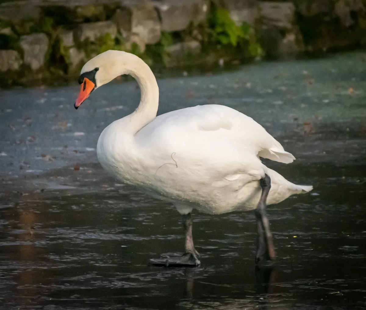
Ireland’s worst cold spells come when a high settles to the north or east and stops the Atlantic winds. Cold, dry air then flows in from the continent or the Arctic, and with clear skies and light winds the nights become very cold, especially inland and in hollows. Canals and lakes can freeze over, and frost can last all day in the shade.
Such spells are uncommon, and they have become rarer as the climate has warmed. Because of the mild sea, a cold spell usually ends when the Atlantic breaks back in, often with a short burst of snow as the milder air arrives.
More: Heatwaves and cold spellsIce daysFrost and cold valleys
Storms and sting jets
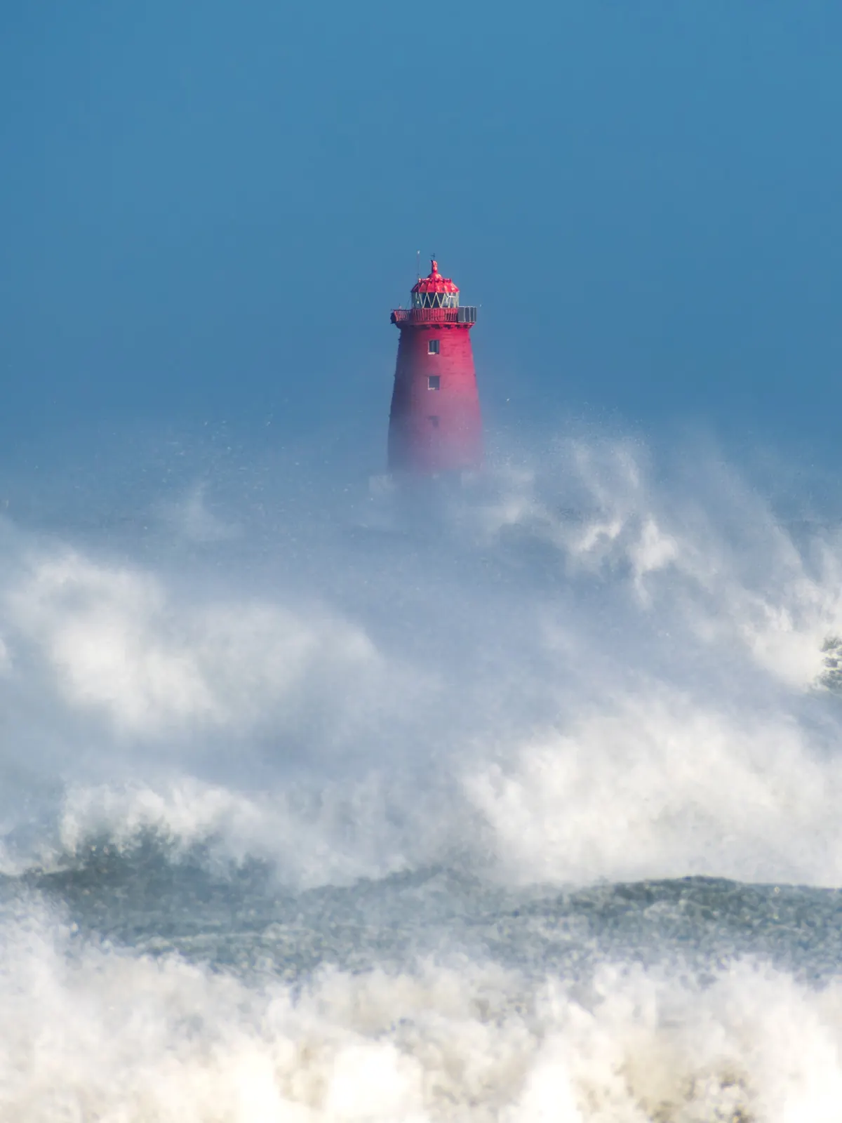
A storm is a deep depression. As its centre deepens, the pressure falls faster and the winds around it strengthen; the closer together the isobars, the stronger the wind. The strongest winds are usually on the southern side of the centre, so a low tracking just north of Ireland is the most damaging path, and the west and north-west coasts are the most exposed.
Since the 2015/16 season, Met Éireann has named storms jointly with the UK Met Office and, since 2019, the Dutch weather service. A storm is named when it is expected to bring orange or red warnings for wind (and in some cases rain).
Some of the fiercest storms have a sting jet: a narrow stream of very fast air that descends from the hooked cloud head at the back of the storm, evaporating cloud as it goes, and reaches the ground as a short burst of extreme gusts over a small area. Sting jets are hard to forecast and last only a few hours, but they can do much of a storm’s damage.
More: Named stormsStorm tracksCompare stormsAir pressure records
Ex-hurricanes
Hurricanes form over warm tropical seas and need that warm water to keep going, so none reach Ireland as true hurricanes. Some, though, are swept north-east by the jet stream and turn into ordinary Atlantic depressions, sometimes deepening again as they do. They can arrive as deep, fast-moving storms carrying tropical moisture, which can mean violent winds, very heavy rain, or both.
Hurricane Debbie in 1961 and Ophelia in 2017 are the best known. Ophelia also turned the sky over Ireland yellow and the sun red, because its winds had drawn up Saharan dust and smoke from forest fires in Iberia. Most ex-hurricanes do far less, and many bring little more than a wet, windy day.
Storm surge and coastal floods
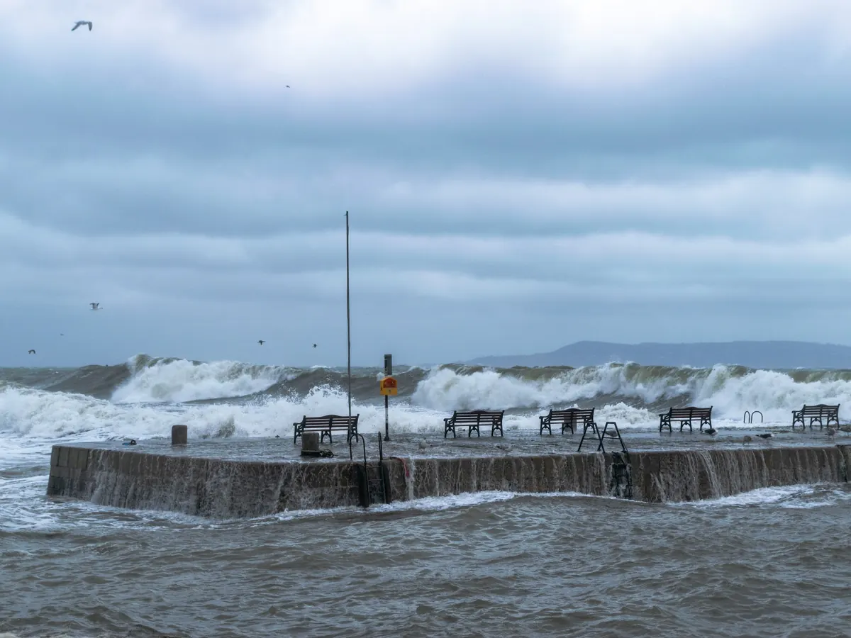
A deep low raises the sea surface beneath it: each hectopascal (millibar) of lower pressure lifts the sea by about a centimetre. Strong onshore winds pile up more water against the coast. Together these make a storm surge, a rise in sea level on top of the normal tide.
A surge at low tide may pass almost unnoticed. A surge at a spring high tide, with big waves driven onshore, is what floods coastal roads and towns. The timing within a few hours makes all the difference, so the same storm can flood one harbour and leave the next one untouched.
Thunder and lightning
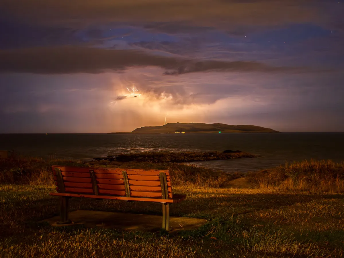
Thunderstorms need warm, moist air rising fast and high. Ireland gets far fewer of them than continental Europe, because the sea keeps its summers cool. The ones it does get come in two kinds. In summer, strong sunshine on warm, humid days builds storms inland in the afternoon; they are most common in the midlands and the east, and many of the biggest arrive in plumes of hot air from France or Spain.
In winter, very cold air moving over a much warmer sea makes the sea itself the heat source. Showers then grow tall enough to bring thunder, hail and sudden squalls to the west and north-west coasts, often at night. The flashes are fewer, but winter lightning can carry more charge.
You can tell roughly how far away a strike is by counting the seconds between flash and thunder: every three seconds is about a kilometre.
More: LightningWhere thunder is heardFog, thunder and hail by seasonThunder, hail, snow and fog
Showers, hail and graupel
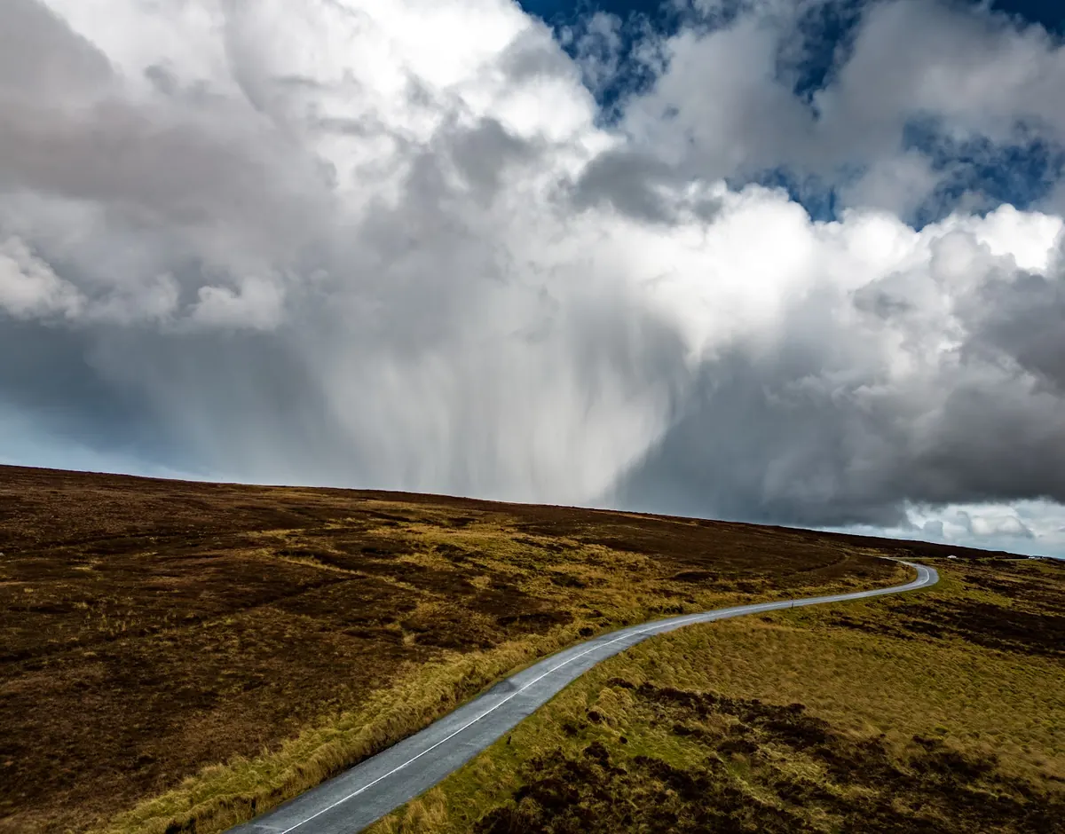
Ireland’s showery days come when cool air sits over a warmer surface: the sea in winter, the land in spring and summer. Each shower is a single cloud with its own life cycle, so a showery day swings between sunshine and downpours within minutes, and two places a few kilometres apart can have very different totals.
Inside a tall shower cloud, ice pellets are carried up and down through supercooled water, gaining layers each time until they are too heavy to stay up. Irish hail is usually small, and much of it is graupel, the soft white pellets of spring and winter showers that bounce like polystyrene. Large hail needs the strong updraughts of a summer thunderstorm and is rare.
More: Thunder, hail, snow and fogFog, thunder and hail by seasonAre downpours getting heavier?
Floods from rain and floods from thaw
Most Irish river floods come from rain: a long run of wet weeks fills the soil and the bogs, and then one more deep depression, or a stalled front, sends water straight off the land into the rivers. Winter is the main season, because evaporation is low and the ground stays wet, but a slow-moving summer thunderstorm can flood a small town in an hour when the water has nowhere to go fast enough.
Snowmelt floods are rarer but can be worse. After a snowy spell, weeks of precipitation are stored on the land as snow. When mild, wet Atlantic air returns, rain falls on the snow and melts it at the same time, often on frozen ground that lets nothing soak in, and rivers rise from both at once. The thaw at the end of the great snows of 1947 brought serious river floods in the south-east, the Nore among them.
Rivers respond at their own pace. Short, steep rivers in the mountains rise and fall within hours. Big lowland rivers such as the Shannon, with lakes and callows along their course, rise slowly and can stay high for weeks after the rain has stopped, so the worst flooding there can come long after the storm that caused it.
More: Rainfall recordsSoil moistureRain minus evaporationSnow eventsEvents and stormsOPW flood maps and past floods (floodinfo.ie)OPW flood extent data (data.gov.ie)
Tornadoes, funnel clouds and microbursts
Ireland gets small tornadoes most years. They are usually brief and weak, lasting a few minutes and travelling a few hundred metres, but enough to lift roof slates, flatten a hedge or throw a trampoline across a garden. Most come from heavy showers or thunderstorms on unstable, showery days, or from the narrow band of intense rain along a sharp cold front, where the wind changes direction and strength over a short distance and the rising air in a shower stretches that spin into a tight vortex.
A funnel cloud is the visible spinning cloud hanging from a shower; it only counts as a tornado when the spin reaches the ground. Over the sea the same thing is called a waterspout. Tornadoes are rated on the T-scale from T0 upwards, and most Irish ones are T0 to T2: real damage along a narrow path, but nothing like the great tornadoes of the American plains.
Not every damaging gust under a shower is a tornado. A microburst is a burst of cold air that plunges out of a storm and spreads out when it hits the ground, so the damage points outwards in straight lines rather than in a twisted track. Weather stations rarely catch either: both are too small and short-lived to pass over an instrument except by chance.
What the wind carries
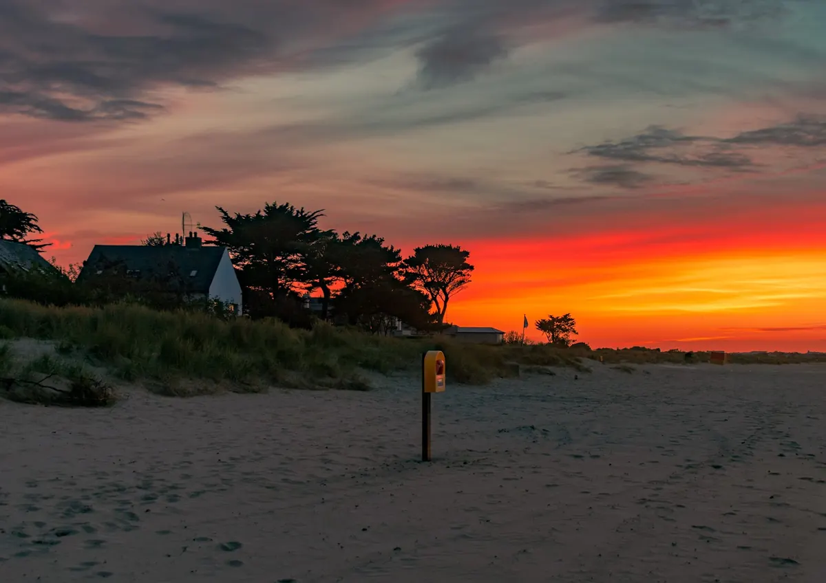
Air that reaches Ireland can bring more than heat or rain. A southerly wind out of North Africa can lift fine Saharan dust and carry it high over the sea; it turns the sky milky, the sun pale or coppery, and leaves a film of orange-brown dust on cars when rain brings it down. Smoke travels the same way: from forest fires in Iberia on the winds of ex-hurricane Ophelia in October 2017, and from wildfires in North America, high in the jet stream, giving vivid red sunsets.
In April 2010, ash from the Eyjafjallajökull eruption in Iceland drifted south-east on north-westerly winds and closed Irish and European airspace for days. In May 1986, radioactive material from the Chernobyl accident in Ukraine reached Ireland on easterly winds, and rain washed much of it into the ground, mostly on the western uplands where the rain was heaviest.
Where any of these ends up depends on the wind that carries it and on the rain that brings it down, which is why the same plume can leave one county almost untouched and the next one dusted.
More: Air quality and the weatherWhich winds bring rainEx-hurricanes
How the climate is changing
Ireland has warmed over the past century, along with the rest of the world, and most of that warming has come since the 1980s. Warm records now outnumber cold ones, frosts are fewer, the growing season is longer, and the seas around the island are warmer. Rainfall has changed less clearly, but wet years and very wet days have become more common, especially in the west.
The main cause is the build-up of greenhouse gases, measured at Mace Head on the Galway coast in some of the cleanest air in Europe. Year to year, the weather still swings widely, with cold winters and poor summers still possible, but the odds have shifted towards warmth. The almanac’s pages show the changes station by station, from the station’s own readings.
More: How Ireland’s climate has changedIreland’s temperature since 1900Records by decadeTrendsGreenhouse gases at Mace HeadYour area’s climate in the future
The sky: light, clouds and space weather
The aurora (northern lights)
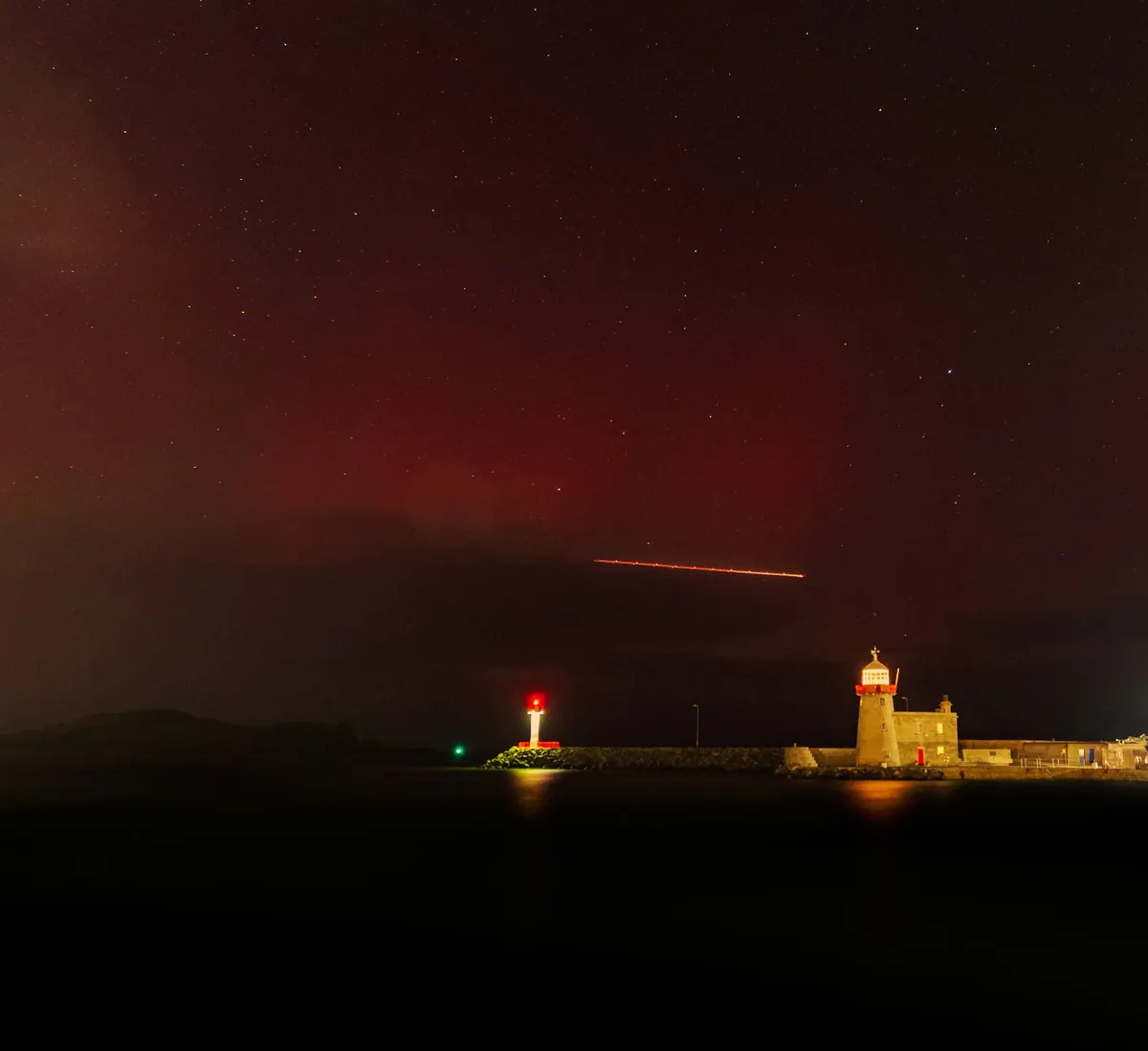
The aurora is light given off high in the atmosphere, about 100 to 400 km up, when fast particles from the sun are steered by the earth’s magnetic field into the upper air and strike oxygen and nitrogen. Oxygen glows green lower down and red higher up; nitrogen adds pinks and purples at the lower edge.
It usually stays over the Arctic, but after a big outburst from the sun (a coronal mass ejection) the auroral oval spreads south, and Ireland, particularly the north coast, gets a view. Forecasters rate geomagnetic storms on the Kp scale from 0 to 9: around Kp 5 or 6 the aurora may be seen low on the northern horizon from a dark site in the north, while a Kp 8 or 9 storm, as on 10 May 2024, can put it overhead across the whole island. Strong displays come most often around the peak of the sun’s eleven-year cycle, and that peak has just passed.
Phone cameras pick up colour the eye often misses, so a faint grey glow to the north can turn out red and green in a photo. Go somewhere dark with a clear view north, away from street lights, and give your eyes twenty minutes. Clear skies are the real limit in Ireland: a strong storm under cloud is no show at all.
More: Aurora history since 1932Sunrise, sunset and twilightFog hours and clear days
Noctilucent clouds and the summer twilight
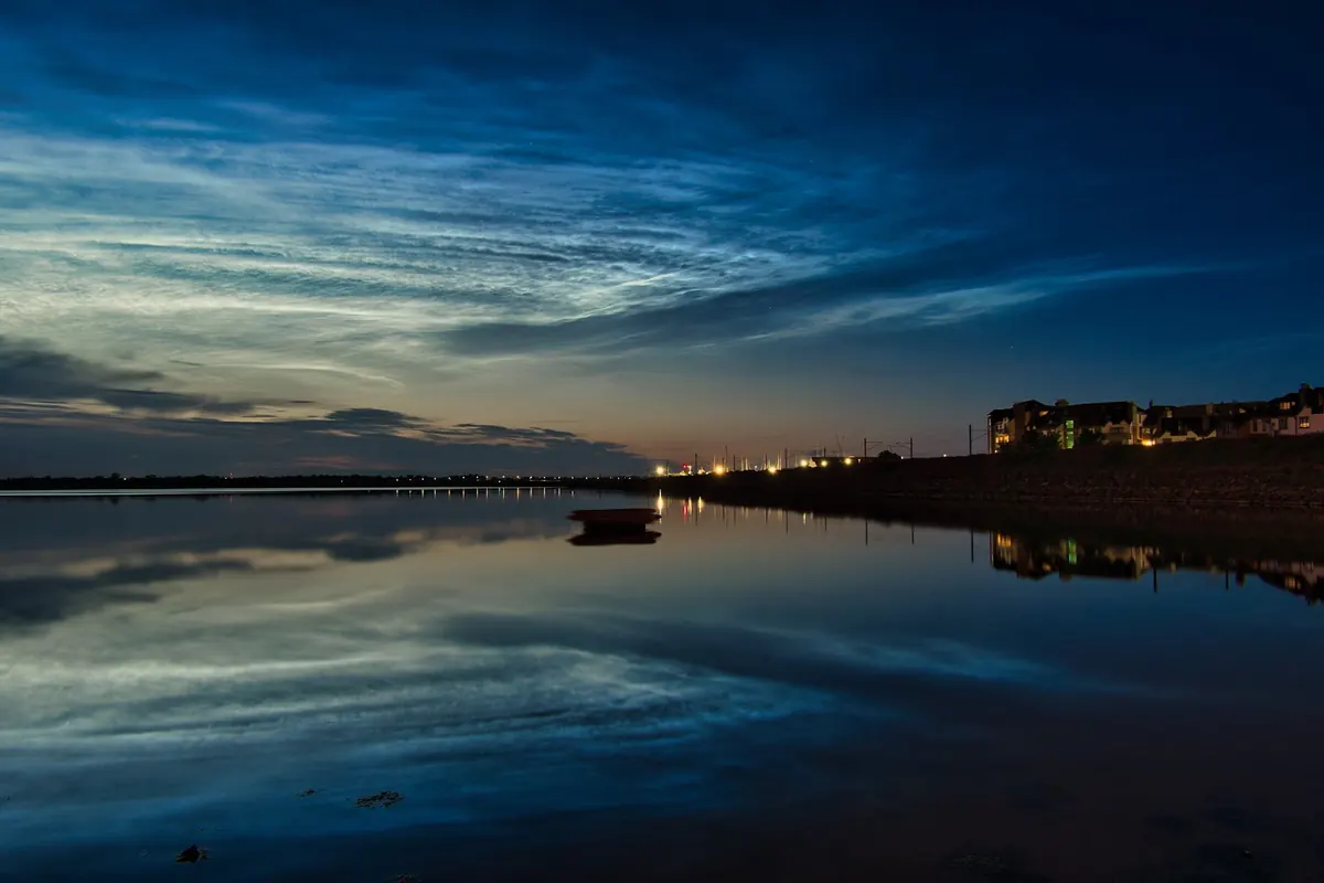
Noctilucent (“night-shining”) clouds are the highest clouds of all, about 80 km up, far above the weather, made of ice crystals that form on specks of meteor dust in the bitterly cold upper atmosphere of high summer. They are seen only when the sun is between about 6 and 16 degrees below the horizon: dark enough below, but with sunlight still reaching that height. They glow electric blue and silver, low in the north, an hour or two after sunset or before sunrise.
Ireland is well placed to see them from late May to early August. They come in rippled sheets and fine bands, and on the best nights they can climb a good way up the sky.
It is also why June nights never get fully dark in Ireland. Around midsummer the sun does not sink 18 degrees below the horizon anywhere on the island, so there is no astronomical darkness: a band of twilight drifts around the northern sky from sunset to sunrise.
Halos, sun dogs and arcs
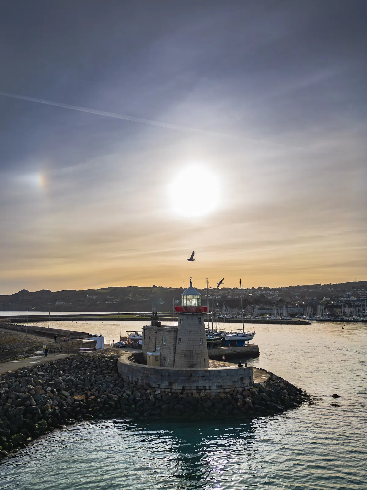
Thin, high cloud such as cirrostratus is made of tiny six-sided ice crystals. Light passing through them is bent by 22 degrees or more, which makes a ring around the sun or moon: the 22-degree halo, about the width of an outstretched hand at arm’s length from the sun. When the crystals are flat plates that float level, they make sun dogs instead: bright spots, often tinged red on the side nearest the sun, level with the sun on either side, clearest when it is low.
Look carefully and you may see other arcs too: a tangent arc touching the top of the halo, a rainbow-bright circumzenithal arc high overhead, or a white parhelic circle running level through the sun. Halos are more common in Ireland than rainbows, but most go unnoticed because few people look near the sun (do not look straight at it).
The old saying “a ring around the moon means rain soon” has something in it. Cirrostratus often spreads ahead of a warm front, so a halo is frequently the first sign of rain arriving within a day.
More: Depressions and fronts
Sun pillars
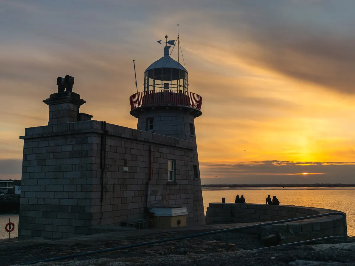
A sun pillar is a vertical shaft of light rising above (or below) the sun when it is low, near sunrise or sunset. It is made by flat ice crystals in high cloud or freezing air, tilting slightly as they fall, so that their faces reflect the sun like a field of tiny mirrors. In frosty weather, street lights can make light pillars in the same way.
Glories and fogbows
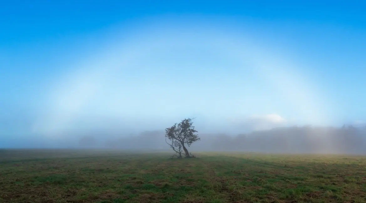
Stand with the sun behind you facing fog or cloud, from a hill, a building or an aircraft, and you may see your own shadow inside a set of small coloured rings. That is a glory. It is made by light scattered back from tiny water droplets, and it always sits at the antisolar point, directly opposite the sun.
Around it there may be a fogbow: a broad white rainbow made by the same tiny droplets. Fog droplets are too small to split light into strong colours, so the bow is white with only faint red and blue edges. The tall fog inversions of autumn and winter, seen from above, are the best time to look for both.
Rainbows
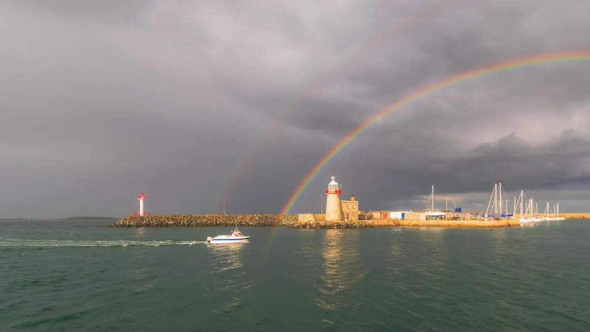
A rainbow is sunlight reflected inside raindrops and split into its colours. Every rainbow is a circle centred on the point directly opposite the sun, with the primary bow about 42 degrees from it, so you only see one with the sun behind you and rain in front of you. The higher the sun, the lower the rainbow, and when the sun is more than 42 degrees up, the bow is below the horizon.
A fainter secondary bow, with its colours reversed, sits about 51 degrees out, and the sky between the two is noticeably darker. Ireland’s showery westerlies make rainbows common, especially on spring and autumn days when showers and sunshine take turns. Morning rainbows are seen in the west, where showers are coming; evening rainbows are seen in the east, where showers have passed.
More: Which winds bring rain
Crepuscular rays
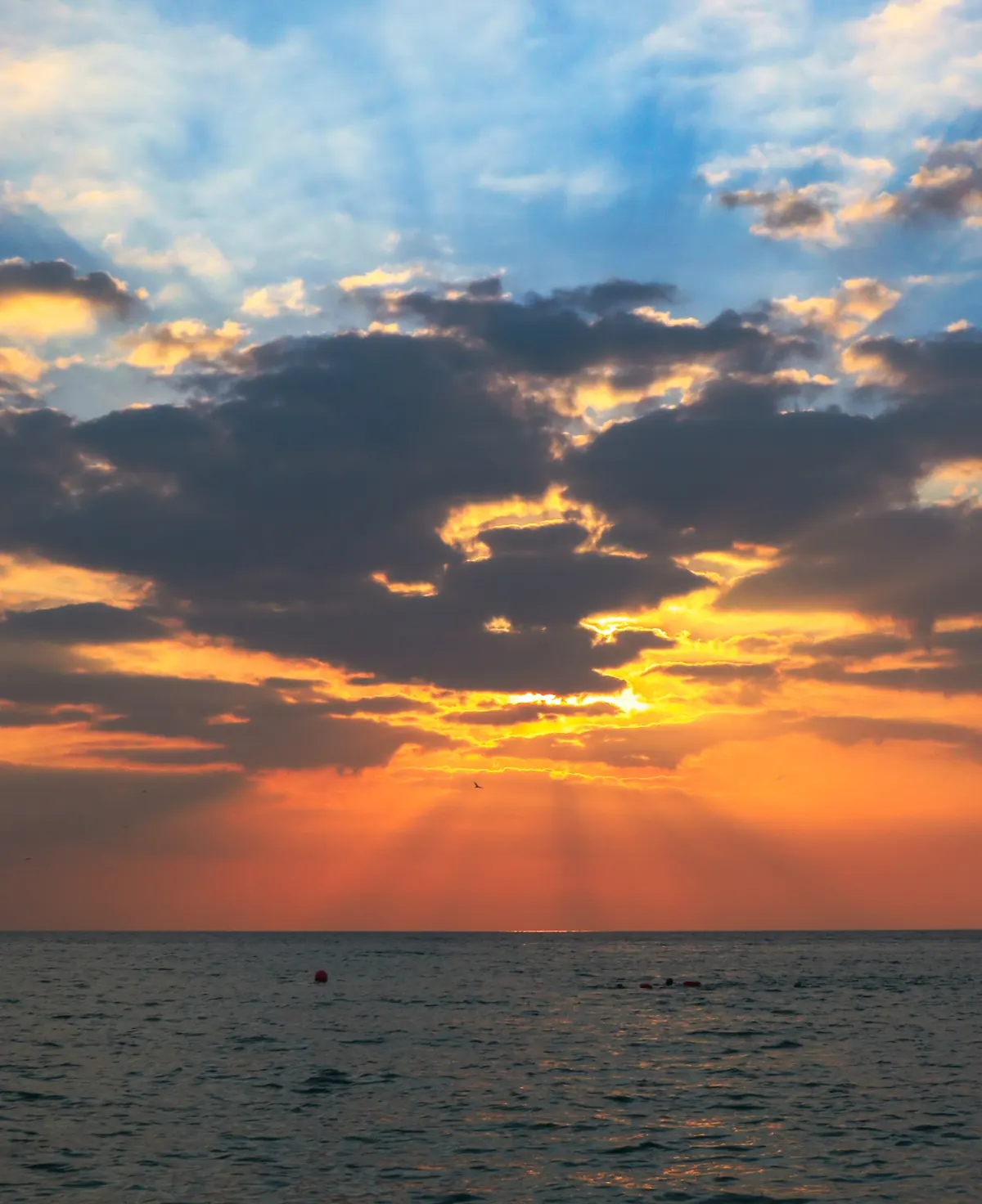
When the sun is behind a cloud, gaps in the cloud let shafts of light through, lit up by haze and dust in the air, with shadows in between. These crepuscular rays look as if they fan out from the sun, but they are really parallel, and only seem to spread out for the same reason railway lines seem to meet in the distance. Sometimes the rays can be traced across the whole sky to converge again opposite the sun as anticrepuscular rays.
Mirages
Light bends as it passes through layers of air at different temperatures. Over a hot road, air near the surface is warmer than the air above, and light from the sky is bent upward, giving the “wet road” of an inferior mirage. Over a cold sea in spring the reverse happens: cold air near the water with warmer air above bends light downward, so distant islands, ships and headlands are lifted, stretched or stacked in a superior mirage.
From the Dublin coast, Lambay, Rockabill and the Welsh mountains can appear to float above the sea. At sunrise and sunset, the same layering can squash the sun into odd shapes, flatten it into an Etruscan vase, or add a brief green flash at the last moment.

Mammatus
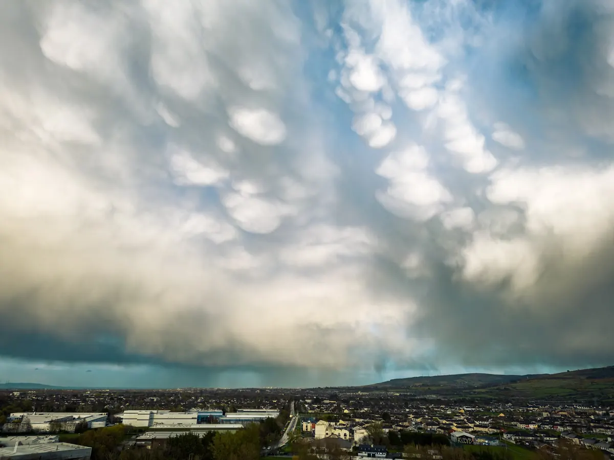
Mammatus are rounded pouches hanging from the underside of a cloud, most often the spreading anvil of a shower or thunderstorm. They form where cold air laden with cloud and ice sinks into drier air below, the reverse of the rising bubbles that build a cumulus. They usually appear as the storm moves away, and are at their most striking in low evening sunlight.
More: Thunder and lightning
Lenticular and wave clouds
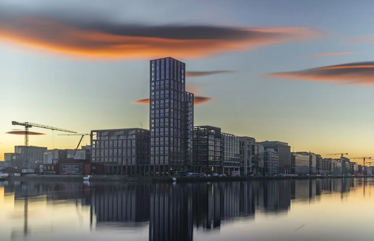
When a strong, steady wind blows across a mountain range, the air bounces up and down downwind in waves, like water flowing over a rock in a stream. Where the air rises in each wave crest, it cools and forms a smooth, lens-shaped lenticular cloud that stays still while the wind blows straight through it. The Wicklow Mountains make them over south Dublin in south-westerly and southerly winds.
Kelvin–Helmholtz clouds form where one layer of air slides fast over another, like wind over water, curling the top of the cloud into a short-lived row of breaking waves. Both are signs of wind shear and turbulence aloft.
More: Mountains and coasts
Virga
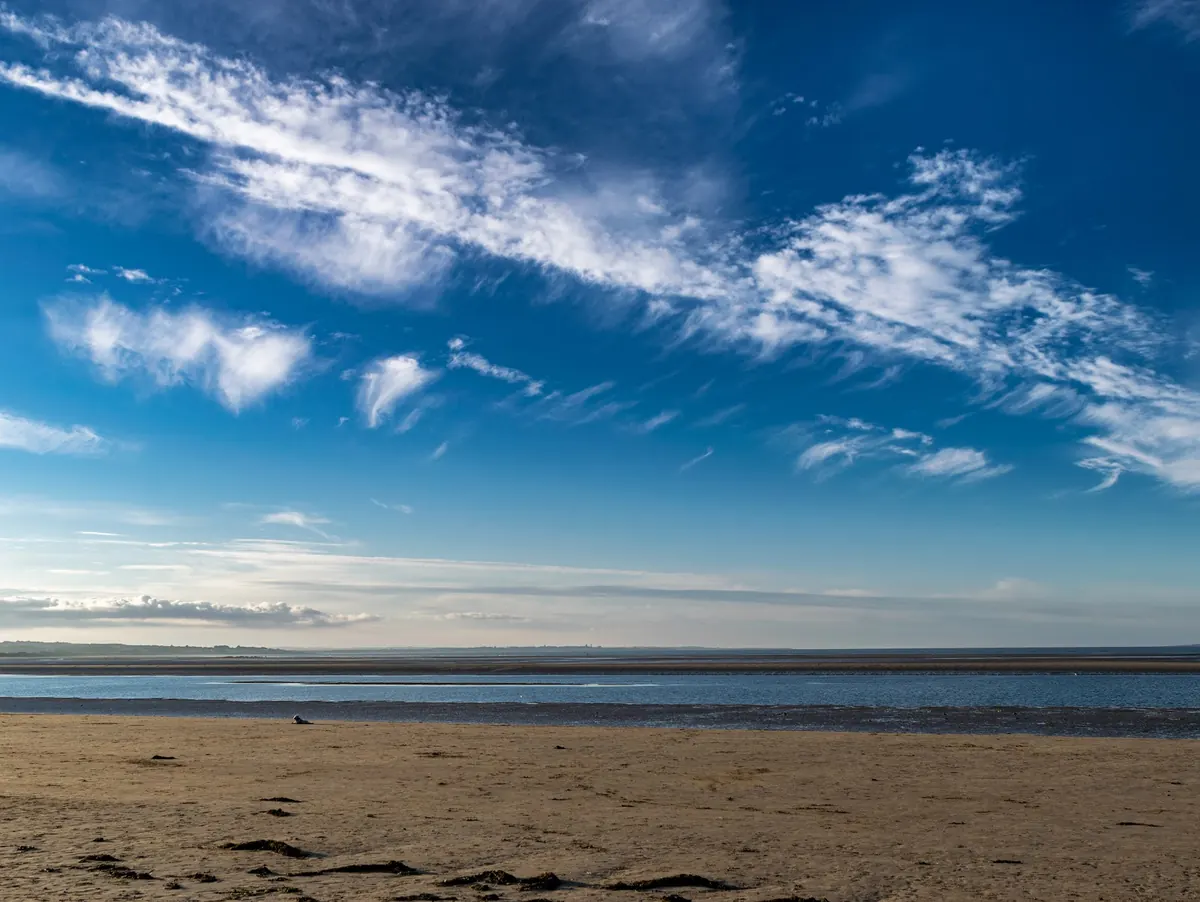
Virga is rain or snow that evaporates before it reaches the ground, seen as wispy streaks trailing from the base of a cloud. It is common from mid-level clouds when the air below is dry. The evaporating rain cools the air, which can sink and reach the ground as a sudden gust, even though no rain arrives.
Supermoons and the moon illusion
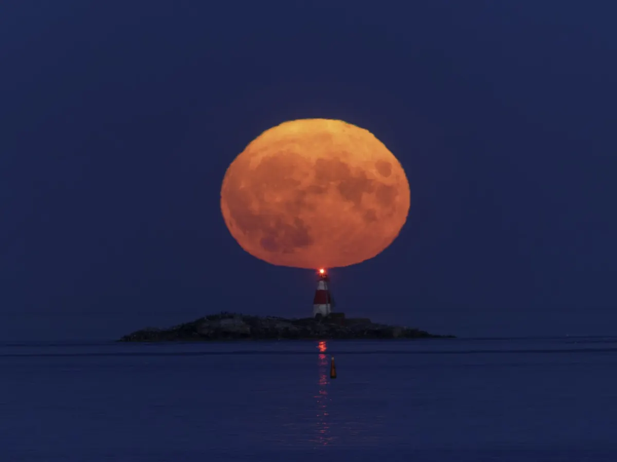
The moon’s orbit is an ellipse, so its distance varies. A full moon near its closest approach, a supermoon, looks a little larger and brighter than one at its furthest: noticeable side by side in photos, but hard to see by eye.
The much bigger effect is the moon illusion. A moon low on the horizon looks huge, but a photo shows it is the same size as when it is high in the sky. The illusion is in the brain, not the atmosphere: the horizon, buildings and hills give the eye something to compare it with. What the atmosphere does do is make the rising moon orange and squashed, for the same reasons the setting sun is red and flattened.
Eclipses
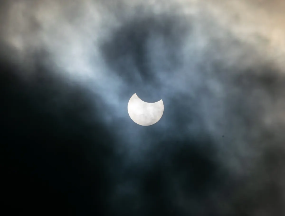
A solar eclipse happens when the moon passes between the sun and the earth. Only a narrow strip sees a total eclipse; everywhere for thousands of kilometres around sees a partial one. Ireland had a deep partial eclipse low in the western sky on the evening of 12 August 2026, when the path of totality passed over Iceland and Spain. The next total eclipse to cross Ireland itself is in 2090.
A lunar eclipse, when the earth’s shadow falls on the moon and turns it a coppery red, can be seen from anywhere the moon is up. Irish cloud is the main obstacle to both, and often an eclipse is glimpsed only through gaps.
Never look at the sun directly, even when most of it is covered: use proper eclipse glasses or project its image.